On 20th November 2009, I had a chance to visit Santa Rita Experimental Range. It was a short visit just to have a general idea about the area. I saw the set ups for measuring the meteorological parameter like rainfall and hydrological parameter like sedimentation, which are worth mentioning here.
The rain gauge was used to measure rainfall in the area. It was present in all the watersheds in the area. Rain gauge was a simple set up of cylindrical jar-type structure, that collects rain water and measures. There was a solar panel beside the set up that provide energy. Data were digitally being recorded from this set up.
To measure the sedimentation rate, a metallic curvature was formed on the water-way. During the flow season, when water flows through the metallic section, sediments pass through the holes in the metal and pass to a pipe in the lower part through which it gets deposited in a tank. Data from here is also digitally recorded.
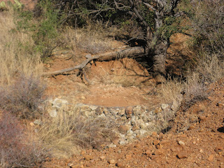
On the route of water - flow, there were small blocks of netted rocks acting as gabion wall that reduced the water velocity and contributed in sediment deposition.
Friday, November 27, 2009
Subscribe to:
Post Comments (Atom)


No comments:
Post a Comment